Background
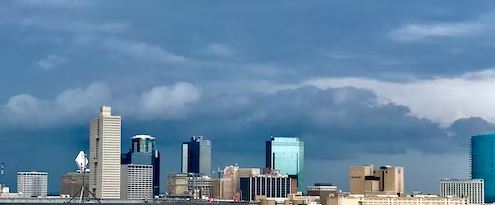
The Dallas-Fort Worth Metroplex, commonly known as DFW, North Texas, or The Metroplex, is a major region in Texas’s Prairies and Lakes. The Dallas-Fort Worth-Arlington, TX Metropolitan Statistical Region has a population of slightly more than 6.4 million people, making it the most populous metropolitan region in Texas and the fourth most populous in the United States, according to the 2010 census. The US government defines Collin, Dallas, Delta, Denton, Ellis, Hunt, Johnson, Kaufman, Parker, Rockwall, Tarrant, and Wise counties. It is bordered by Dallas on the east and Fort Worth on the west.
Dallas Fort-Worth Metroplex Geography
The Metroplex has a total area of 9,286 square miles or 24,100 square kilometers. The land covers 8,991 square miles (23,290 square kilometers), whereas water covers 295 square miles (760 square kilometers).
What is a Conurbation?
A conurbation is a region comprised of several metropolises, cities, big towns, and other urban areas amalgamated due to population development and physical expansion to form one continuous urban or industrially developed area. In most situations, a conurbation is a polycentric urbanized area with transportation created to connect places to form a single urban labor market or commute to a work area.
Dallas Fort-Worth Major Cities
This area is made up of three major cities: Dallas, Fort Worth, and Arlington. Each city is connected by city borders or suburbs. The area is also known as the Dallas-Fort Worth Metroplex because it contains more than one major anchor city of roughly similar size or importance, and it is part of the Texas Triangle, a growing megalopolis. TracyLocke, a local advertising firm, designed it. In 1972, the North Texas Commission trademarked the term Dallas-Fort Worth Metroplex to replace the formerly prevalent term North Texas.
1. Dallas, Texas
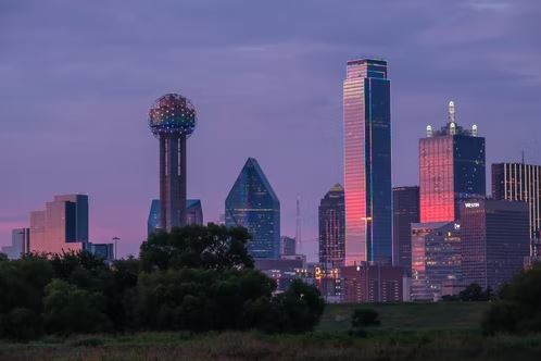
It is the tenth largest city in the United States in terms of population. It is the largest and most populous city in The Metroplex, the county seat of Dallas County, and is widely regarded as the area’s focal point.
Dallas is in north-central Texas, about 70 miles south of the Oklahoma border, 174 miles west of Louisiana, and about 250 miles north of the Gulf of Mexico. The city is located on the undulating plains near the Trinity River’s headwaters, in an area known as the Blackland prairies, roughly halfway between the Piney Woods of east Texas and the Great Plains. The surrounding area has an unusually high proportion of man-made lakes. Its climate is humid and subtropical, with scorching summers, mild winters, and little snowfall. There are approximately 60 lakes and over 50,000 acres of public parkland within a 100-mile radius of the city. The rainy season lasts from April to May, with July and August being the driest months.
History
Dallas’ enormous metroplex includes Arlington and Fort Worth, with a population of over six million people and a gross yearly metropolitan output of $374 billion.
In just 170 years, Dallas has risen from its humble beginnings as a tiny colony to a massive achievement powered by oil and gas.
Early Beginnings
The first pioneer to settle in the area, John Neely Bryan, built a log cabin and trading post at a natural ford on the eastern side of the Trinity River in 1841 and was soon joined by two additional families.
By 1845, several more pioneers had established themselves on the western river bank, in what was known as the Republic of Texas. Ten years later, the little towns were joined by a group of Swiss, Belgian, and French artists and musicians whose ‘utopian’ endeavors west of town had failed. Their inventiveness and culture can still be seen in modern districts like Greenville Avenue and Deep Ellum.
The Growth of Dallas
From 1861 to 1865, Dallas was home to slightly under 700 individuals, several of whom were African-Americans who had seceded from the Union and joined the Confederate states of the south. Dallas was growing rich at this point in its history because of the entrance of the railroad and multiple stagecoach lines.
Most inhabitants supported segregation, and the town was spared war and destruction since it was located far from the main battlegrounds. However, with the release of the city’s slaves and the entrance of freed slaves from other regions, the reconstruction phase following the Union triumph in 1865 brought substantial changes, including the rise of the Ku Klux Klan in the late 1860s.
Before the Civil War, the city’s wealth was based on agriculture, specifically grain and cotton, but the later years of the nineteenth century witnessed the beginnings of industrial growth in the region, fueled by the fall of cotton prices. The administration supported the construction of the Dallas Zoo, two hospitals, many colleges, and a library, as well as the foundation of the State Fair of Texas, which is held annually from late September to mid-October.
20th Century and later
Dallas was a large producer of wholesale alcoholic beverages, pharmaceutical goods, publications, media items, and jewelry by 1900. The city kept a foothold in the domestic cotton and grain markets, and it was the world leader in cotton gin engineering and manufacturing. Although a huge flood in 1908 caused significant property destruction and the ultimate installation of levees, the transition from agriculture-related dependency to financial services as an economic staple occurred gradually.
After surviving the Great Depression, the city’s true golden era began with the discovery of oil, launching the East Texas oil boom, with the city’s financial geniuses playing a key role. The Texas Centennial Exhibition opened in 1936, producing 50 new structures and garnering 10 million visitors.
Dallas is one of the top metro regions drawing new inhabitants, and it’s simple to understand why. It’s known for the Dallas Cowboys and five other professional sports teams, Tex-Mex cuisine, booming art, and music scenes, and world-class attractions. Despite significant urban development, the Dallas Area Rapid Transit (DART) system is the country’s longest light rail system. The Dallas Museum of Art, the Dallas World Aquarium, and the Dallas Arboretum and Botanical Garden are among the city’s main attractions.
Geographic Coordinates and Climate of Dallas, Texas
Dallas is in north-central Texas, about 70 miles south of the Oklahoma border, 174 miles west of Louisiana, and about 250 miles north of the Gulf of Mexico. The city is located on the undulating plains near the Trinity River’s headwaters, in an area known as the Blackland prairies, roughly halfway between the Piney Woods of east Texas and the Great Plains. The surrounding area has an unusually high proportion of man-made lakes. Its climate is humid and subtropical, with scorching summers, mild winters, and little snowfall. There are approximately 60 lakes and over 50,000 acres of public parkland within a 100-mile radius of the city. The rainy season lasts from April to May, with July and August being the driest months.
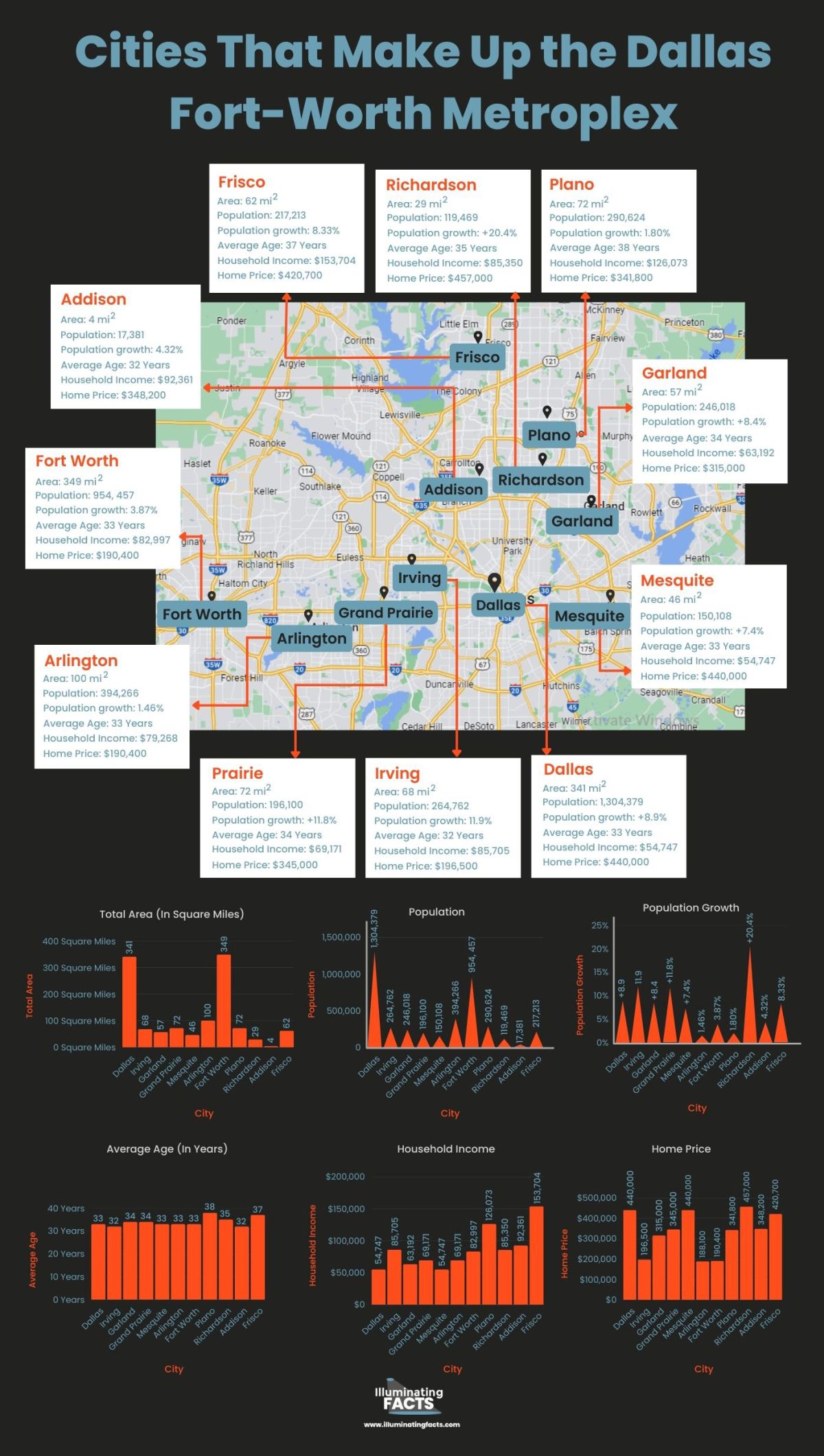
- Area: 341 square miles
- Average Temperatures: 66.42 degrees Fahrenheit
- Elevation above sea level: 139 m = 456 ft
The Population Growth of Dallas
Dallas is one of the main U.S. cities with the highest population growth, and Texas has been driving that expansion for the past few years. Texas has had the state’s fastest population expansion, particularly in the northern suburbs of Dallas-Fort Worth. With a growth rate of roughly 2%, Dallas was the fourth-fastest-growing city in 2014. The Dallas-Fort Worth region has grown by more than double during the last 30 years.
- Population: 1,304,379
- Population growth: +8.9% from 2010 to 2020
- Average age: 32.9
- Average household income: $54,747
- Average home price: $440,000
2. Irving, Texas
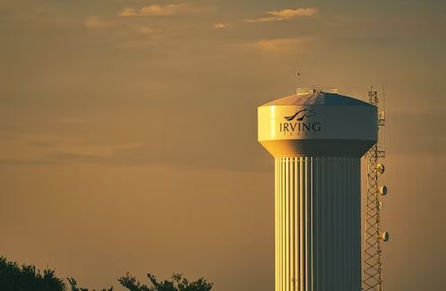
Irving is a major city in Dallas County and the DFW Metroplex. It is one of the inner ring Dallas suburbs and one of only seven DFW cities with a population of more than 200,000 inhabitants.
Irving is part of the Dallas-Fort Worth metropolitan area. According to a 2019 estimate from the United States Census Bureau, the city’s population was 239,798 people, ranking it thirteenth in Texas and 93rd in the United States. Irving is known for its racial and ethnic diversity, and it has been named one of the most diverse cities in America. Irving is part of the Dallas-Fort Worth International Airport and includes the Las Colinas mixed-use master-planned development.
History
In the 1850s, settlers moved to Irving. Sowers, Kit Shady Grove, Union Bower, Finley, Estelle, and Bear Creek were all established in the final half of the century. Irving was started in 1903 by J.O. In the years that followed, Schulze and Otis Brown scooped up the majority of these payments.
Early Years
Schulze and Brown arrived in 1902 to evaluate a railroad route between Fort Worth and Dallas for the Chicago, Rock Island & Gulf Railway. They purchased 80 acres from the Britain family in 1902 after deciding that this area would make an excellent town site. On December 19, 1903, the co-founders held a public auction to sell the first town lots. The adjacent Kit post office was relocated to Irving in 1904, and the town of Irving was founded on April 14, 1914. The City Council formally designated novelist Washington Irving as the city’s namesake in 1998.
According to local historians, Brown and Schulze named the city after Netta Barcus Brown’s favorite author. Schulze, a University of Iowa graduate engineer and member of the Washington Irving Literary Society, was likewise fond of the name Irving.
The Growth of Irving
Irving advanced quickly over the next few years. The Irving Independent School District was established in 1909 by the Texas legislature with a student population of around 190. Four years later, for the astonishing sum of $15,000, the area constructed its first brick building. The small town became a legal entity in 1914 when its residents voted 27 to 16 to incorporate. They chose Otis Brown as their first mayor and a three-member City Commission.
Irving was a center for cotton production, truck and dairy farming, and chicken production during this period. Farmers sometimes traveled to Dallas to sell their crops, and if the Trinity River overflowed while they were on the east bank, they couldn’t return home until the water retreated.
Mid-Century of Irving
Irving had grown to a population of 2,615 people and was on the verge of tremendous growth. City Commissioners absorbed surrounding territories to meet the 5,000-person requirement for a home rule charter election. The proposed charter was approved by a vote of 377 to 96 on October 15, 1952. The charter introduced four commissioners, established a city manager, and granted Irving more autonomy.
Irving welcomed the University of Dallas and recruited its first paid firefighter. Businesses kept moving to the city. Plymouth Park Shopping Center was one of the largest shopping centers between Dallas and Fort Worth when it debuted in 1955. New home construction accelerated, and by 1960, Irving’s population had risen to 45,895.
Irving Community Hospital was founded in 1964. The world’s largest transportation terminal was erected in Irving in the same year. Late in the decade, municipal officials met with the owner of the Dallas Cowboys football club, who was interested in relocating the team to an Irving stadium. The stadium was built with revenue bonds by the city and opened in 1971. Texas Stadium served as the Dallas Cowboys’ home for more than 30 years until the new Cowboys Stadium opened in Arlington in 2009.
Irving’s Modernization
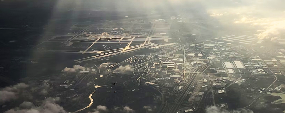
The Dallas-Fort Worth Regional Airport, which is partially within Irving’s limits, began construction in the late 1960s as well. It was the country’s largest airport when it was opened in 1974. The airport, now known as Dallas/Fort Worth International Airport, is the world’s third largest and contributes significantly to Irving’s booming economy.
By 1970, Irving had a population of almost 100,000 people. Three years later, Irving landowner Ben Carpenter saw his goal come true with the launch of Las Colinas, a privately funded, 7,000-acre master-planned community that has grown to include over 1,000 firms, residences, schools, shopping centers, and recreation facilities. The Dallas County Community College District established North Lake College in Irving in the late 1970s.
Irving had significant expansion and change during the beginning of the century. In 2003, the city celebrated its centennial. The Irving Convention Center opened its doors in early 2011 after many years of preparation and construction, welcoming events such as Zest Fest, ComicCon, and the Las Colinas Bridal Show. It was the first step in establishing Irving as a destination city, complete with a conference center, entertainment zone, and headquarters hotel. The following year, in 2012, Irving became the first city in Texas and just the second in the country to receive the prestigious Malcolm Baldrige National Quality Award.
2017 to the Present
In 2017, the Toyota Music Factory delivered one of the country’s most massive and complete concert venues to Irving. There is never a dull moment at Toyota Music Factory, which boasts an unbelievable selection of bars and restaurants and plays host to the top national and international touring music acts, handled by booking superpower Live Nation.
The Westin Irving Convention Center Las Colinas opens in 2019 as the final phase of Irving’s dynamic entertainment district concept, with an energy of its own. The attractively constructed suites with trademark facilities, paired with a star-studded staff, award-winning restaurant and lounge, and convenient location, complete Irving’s new face as a destination getaway.
Irving’s population had surpassed 240,000 by 2017 and was steadily expanding. Irving is the second largest employment center in North Texas, with a workforce of over 3.3 million people. The city is home to 10,600 local and multinational enterprises, including the global headquarters of five Fortune 1000 corporations and 53 Fortune 500 corporations.
Geographic Coordinates of Irving, Texas
The city has a total area of 67.7 square miles (175 km2), of which 67.2 square miles (174 km2) is land and 0.4 square miles (1.0 km2), or 0.65%, is water.
- Irving’s Area: 67.7 square miles or 175 square kilometers
- Height above sea level: 151 meters (495 feet)
- Elevation above sea level: 151 meters (495 feet)
The Population in Irving, Texas
Irving’s population increased slowly throughout its first few decades as a city, but between 1950 and 1960, it increased by 1,654.5%, from 2,621 to 45,985 people. Since then, Irving’s population has steadily increased, reaching over 240,000 today.
Irving’s population increased by 1.57% between 2016 and 2017, and it is anticipated that it will continue to expand at a similar rate going forward.
- Population: 264,762 (as of 2020)
- Average Household Income: $85,705
- Poverty Rate: 11.9%
- Rental Cost: $1,192 per month
- Average House Value: $196,500
- Average Age: 32 Years
- Elevation: 495 feet above sea level
3. Garland, Texas
Garland’s population has decreased since the 2020 census, moving it to third place among Dallas’ cities. Although a little piece of it does reach Rockwall and Collin counties, it is almost entirely contained inside Dallas County. Garland is well-known for its manufacturing sector, straightforward access to Dallas’s downtown, family-friendly attractions, lake enjoyment, and first-rate parks and open areas.
History
Early Years (the 1900s)
Garland leaders were shocked to discover that the majority of privately held utility companies were more focused on making money than collaborating with small communities when more urban areas started to receive power connections. On April 1, 1923, Garland began providing electricity to its residents with a loan of a small generator from the Fairbanks-Morse Firm, with the understanding that revenues would pay back the company.
This was the beginning of Garland Power & Light. Despite their devastation, the World Wars were a boom for the small, still largely agrarian Garland. Manufacturing facilities were quickly built by businesses like Luscombe, which resulted in money and an expanding population. With more than 300 manufacturers, Garland is currently one of Texas’ largest manufacturing communities.
Garland’s status as a major cultural hub in North Texas was cemented in the latter decades of the 20th century. To preserve and promote Garland’s heritage, the Garland Landmark Society was established in 1972 and is still active today. The Garland Summer Musicals, Garland Civic Theatre, and Garland Symphony Orchestra call the Garland Performing Arts Facility, now known as the Granville Arts Center, home. It opened in 1983 and made Garland the first Dallas suburb with an arts center.
21st Century and Present
Garland’s population growth has slowed in the twenty-first century as vacant land becomes increasingly scarce and the city nears buildout. The City of Garland, which is currently a significant manufacturing and industrial base for the entire D/FW Metroplex, is ranked 12th in terms of population in Texas and 91st overall according to the Census Bureau’s 2015 American Community Survey, with an estimated population of 237,000.
Garland, the third-largest city in Dallas County, has two DART Blue Line stations and has easy access to downtown Dallas via public transit. Garland, a culturally diversified city next to northern and eastern Dallas, has a long history and the locals enjoy a wide variety of outdoor activities, shopping, the arts, and special events.
Geographic Coordinates of Garland, Texas
Garland can be found at 32°54′26′′N and 96°38′7′′W. The land makes up the city’s total area of 57.1 square miles (147.9 km2).
The Population in Garland
Garland’s population is 246,018 as of the 2020 Census, an increase of 19,142 people (8.4%) from the 2010 Census. The city ranks 92nd in the nation for population density with 4,297 people per square mile. The predicted population of Garland in 2021 is 247,55.
- Population: 246,018
- Population growth: +8.4% from 2010 to 2020
- Area: 57 square miles
- Average age: 34
- Average household income: $63,192
- Average home price: $315,000
- Garland Crime Rate: 2,811 crimes per 100,000 residents, which is 20% more than the national average.
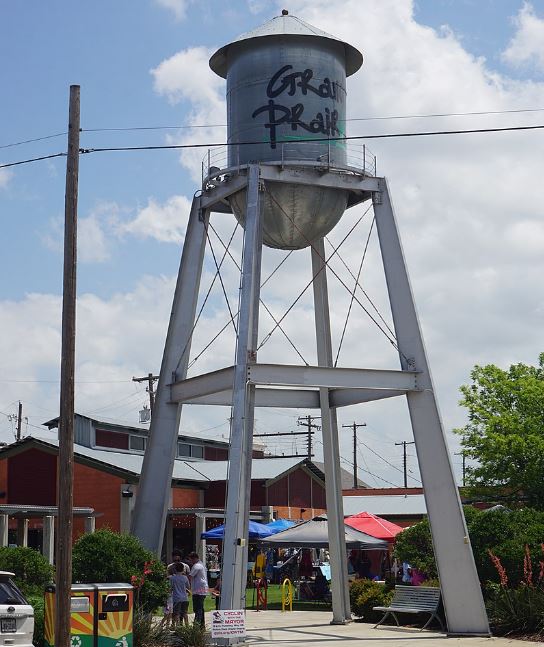
4. Grand Prairie, Texas
One of the major cities in Dallas-Fort Worth is in Grand Prairie. It is primarily in Dallas County but also includes parts of Tarrant and Ellis counties. It is a part of the Mid-Cities region. This multicultural community is renowned for its low crime rate, water leisure, and family enjoyment.
Many families call Grand Prairie home, the majority of which have young children and two incomes. Grand Prairie, Texas, was recently named one of the greatest cities in Texas by Money and is frequently regarded as one of the best places to live in Dallas, Texas.
History
The City of Grande Prairie was designated as the Home of the Trumpeter Swan not long after it gained its incorporation in 1958. The swans were found to be breeding in the Grande Prairie region in 1926 by a visiting representative of the Canadian Wildlife Service. Since then, the swan has been saved from the endangered species list thanks to a combination of protective legislation, good wildlife management, and collaboration between Canada and the United States.
Grande Prairie had been steadily growing into the main service hub in the Peace River area ever since it was granted cityhood. Between 1958 and 1975, the population more than doubled, and the economy grew twice as fast as the national average.
In late 1977, when the Elmworth Deep Basin Gas Field was discovered, Grande Prairie’s already robust economy quickly reached “boom” status. In the fall of 1979, a housing crisis hit the city as rents surged. Costs of housing and construction both climbed significantly. Before the 1981 crisis, the economy was in a “boom” state for nearly five years. A subsequent boom in 2006–2007 brought thousands of new people to Grande Prairie in a very short amount of time. The City responded rapidly to challenges caused by abrupt, rapid growth by adapting and reducing them.
Since that time, Grande Prairie has grown steadily and aspires to be a pioneer in inventiveness and ingenuity. Major Projects like the Eastlink Center and the Community Knowledge Campus serve as shining examples of the City’s continued commitment to setting the standard for the future.
Grand Prairie’s Geographic Coordinates
The city has a total area of 81.1 square miles (210.0 km2), of which 72.1 square miles (186.8 km2) is land and 9.0 square miles (23.3 km2), or 11.08%, is water.
Population of Grand Prairie
The Texas city of Grand Prairie is situated in Dallas County. Grand Prairie will have 200,240 residents in 2020. Grand Prairie’s population has grown by 2.11% from the most recent census, which showed a population of 196,100 in 2010. The city is now expanding at a pace of 1.04% annually.
- Population: 196,100
- Population Growth: +11.8% from 2010 to 2020
- Area: 72 square miles
- Average age: 33.6
- Average household income: $69,171
- Average home price: $345,000
- Grand Prairie Crime Rate: 2,170 crimes per 100,000 people
5. Mesquite, Texas
Mesquite is one of the inexpensive cities in Dallas, with housing prices that are 38% lower than those in Dallas, fewer crime, and higher household income all while being only 14 miles from the city’s center. With a small area in Kaufman County, Mesquite, Texas is located primarily in Dallas County. Mesquite is renowned as the Rodeo Capital of Texas, hosting weekend rodeo events from June to August along with other special events.
Mesquite History
Early Beginnings
The initial record for the township of Mesquite was filed in Dallas County by Texas and Pacific Railroad Agent A.R. Alcott in 1873, which marks the beginning of the history of downtown Mesquite. A short while later, the train was running between Shreveport and Dallas, and it was making quite a sensation among the newcomers. Although it is unknown how the city got its name, many believe it was because of the region’s large number of mesquite trees.
Wood-framed commercial buildings lined Front Street in the 1870s, which then served as the community’s first street. There were four dwellings, a station, a tavern, a blacksmith shop, a candy shop, and the post office in the town itself. The municipality would wait 14 years before attempting to become incorporated. Voters approved Mesquite’s incorporation on December 3, 1887, making it the second community outside of Dallas to do so. J.E. was elected in April 1888. Russell was elected mayor.
The Growth of Mesquite Texas to the present
The ambition to replace older wooden structures with modern brick buildings gained momentum with the establishment of a new brick plant west of town. The front entrance of downtown buildings was changed to face the square, which is now located between Davis and Main streets, along to establish an official town square.
Downtown has changed over the years because of war, economic booms and busts, sprawl, population increase, and cultural shifts. The real heart of Mesquite is still here, where it has been for many years.
Geographic Coordinates of Mesquite, Texas
Mesquite is a component of the Dallas-Fort Worth-Arlington metroplex, which is home to one-fourth of all Texans. Its total area is 46.2 square miles (119.6 square kilometers), of which 46.0 square miles (119.2 square kilometers) are land and 0.52 square miles (0.2 square miles), or 0.33%, are water.
Population
The Texas city of Mesquite is situated in Dallas County. 2020 will see 152,164 people living in Mesquite. Mesquite’s population has grown by 1.37% since the most recent census, which showed a population of 150,108 in 2010. The city is currently expanding at a pace of 0.68% yearly.
- Population: 150,108
- Population growth: +7.4% from 2010 to 2020
- Area: 46 square miles
- Average age: 33
- Average household income: $60,715
- Average home price: $300,000
- Mesquite Crime Rate: 3,974 crimes per 100,000 people (69% above the national average)
6. Arlington, Texas
In Tarrant County, Texas, in the United States, there is a city called Arlington. It is a major city in the metropolis and region, and it is a component of the Mid-Cities region of the Dallas-Fort Worth-Arlington MSA.
History
The history of Arlington is intricate, and its identity has changed over more than 150 years. It has served as a frontier outpost, an agricultural hub, a setting for Native American conflicts, and a haven for horse racing and gambling. It was historically well-known for its mineral springs, it has three colleges, and it is home to important industrial facilities like the Arlington General Motors Assembly Plant. However, it also has a high-tech component that includes nanotechnology research, computer chip manufacturing, and a technology incubator designed to bring cutting-edge university research into the world of commerce. It is now famous for Major League Baseball and amusement parks that have enormous roller coasters.
It has a rich history that starts with the Native Americans and continues through the early explorations of the first European explorers and the formation of the Texas Republic. Six different national flags have flown over this location.
At Bird’s Fort in 1843, delegates from nine tribes, including the Cherokee, Delaware, Biloxi, Caddo, Keechie, and Waco, signed the Republic of Texas’ first-ever Indian peace treaty. The area’s oldest known inhabitants were the Caddo tribes, who predominated early Indian towns and camped in such great numbers that one nearby stream, Village Creek, bears their name. Numerous archaeological digs have proven the long-term presence of the early Caddos, who engaged in agriculture close to the stream. The early European travelers to the region, such as Cabeza de Vaca in 1535 and La Salle in 1687, as well as Texas Rangers, who ultimately defeated the Caddo in the Battle of Village Creek in 1841, visited Caddo towns.
These properties eventually became a part of the vast plantation holdings of Col. Middleton Tate Johnson, who took charge of a Texas Rangers company at Johnson Station after returning from the Mexican War in 1846.
Geographic Coordinates of Arlington, Texas
The total area of Arlington is 99.7 square miles (258 km2), or 96.5 square miles (250 km2) of land and 3.2 square miles (8.3 km2) of water. The city lies roughly 20 miles (32 km) west of downtown Dallas and 12 miles (19 km) east of downtown Fort Worth, respectively.
Arlington’s Population
Since the city of Arlington was established in the 19th century, its population has increased. At the time of the 1950 census, there were over 7,600 residents living in the city. This was insignificant considering the subsequent population explosion, which saw a rise of over 482% between 1950 and 1960. Over 60,000 people called the area home in 1980. When the subsequent census was taken, this number increased to almost 261,000. The estimated population of the city expanded by 7.5% during the 2010 census, and this growing metropolis is quickly approaching 400,000 inhabitants.
- Population: 394,266
- Population growth: 1.46%
- Average age: 33
- Average household income: $79,268
- Average Rental Cost: $1,089 per month
- Average home price: $188,100
7. Fort Worth, Texas
The thirteenth-largest city in the country and the fifth-largest in the U.S. state of Texas, respectively, in Fort Worth. As an army outpost on a cliff overlooking the Trinity River, Fort Worth was founded in 1849. The commerce in Texas Longhorn cattle has historically been centered in Fort Worth. With a population that has nearly doubled since 2000, Fort Worth has recently emerged as one of the American cities with the greatest growth rates.
The History of Fort Worth, Texas
The history of northern Texas and the Texan frontier is inextricably entwined with those of Fort Worth, Texas, in the United States. The city has undergone a significant transformation, yet it nevertheless retains many aspects of its past in its contemporary culture, from its early days as an outpost and a threat to Native American occupants through its subsequent years as a prosperous cow town to modern times as a corporate center.
Early Beginnings
At Bird’s Fort, which is now in Euless, Texas, many Indian tribes and the Republic of Texas signed the Treaty of Bird’s Fort in 1843. As of January 1849, the U.S. Veteran of the Mexican-American War Army General William Jenkins Worth recommended the construction of 10 forts to mark and guard the western Texas frontier, located from Eagle Pass to the Trinity River’s West Fork and Clear Fork confluence. Worth passed away from cholera on May 7, 1849.
To fill Worth’s role, General William S. Harney was appointed. He gave Major Ripley A. Arnold the assignment to select a new fort located close to the meeting of the West and Clear Forks. In memory of the late General Worth, Arnold founded a post on the Trinity River’s banks on June 6 and gave it the name Camp Worth. Arnold relocated the camp to a north-facing bluff that overlooked the Clear Fork’s mouth in August 1849. On November 14, 1849, the US War Department formally gave the station the name “Fort Worth”.
The Growth of Fort Worth in the 20th Century
Swift and Armour meat packing firms established operations in Fort Worth in 1902. Their entrance employed thousands of people, significantly improving the town’s wealth. As a result, the town’s population tripled from 26,600 to almost 73,000 people, and it drew migrants from rural areas as well as immigrants. Texas had a divided society that often-kept blacks out of better professions in new industries like meat packing. The Fort Worth Gas Company was founded in 1909 and began supplying over 4,000 customers via a pipeline running 90 miles (140 kilometers) from Petrolia, Texas.
Then oil was discovered in Desdemona, south of Ranger. Hogtown grew to a population of 16,000 people. Then, 30 miles northwest of Ranger, Breckenridge struck gold with large wells. Meanwhile, a test was taking place 135 miles northwest of Fort Worth, right outside Burkburnett. A spectacular well was discovered on the Fowler property, triggering yet another boon. Hundreds of wells were dug in the Ranger-Desdemona-Breckenridge district, with hundreds more in the Burkburnett district. The two main oil booms drew national attention to Texas.
Geographic Coordinates of Fort Worth, Texas
There are 342.2 square miles (886 km2) of land and 7.0 square miles (18 km2) of water in the city’s total size of 349.2 square miles (904 km2). It is the second-largest city in the Dallas-Fort Worth metroplex and a major city.
The Population in Fort Worth, Texas
Between 2010 and 2020, Fort Worth experienced the fastest rate of population growth among large cities, with a total population increase of more than 177,000. This corresponds to an average yearly rise of 17,771 people and a growth rate of 2.4% per year. The significant population growth in Fort Worth has continued for the preceding ten years. The entire population of Fort Worth increased by 200,815 people between 2000 and 2010. This indicates a growth rate of 3.7 percent per year and an average annual rise of about 20,082 people.
- Population: 954, 457 (as of 2020)
- Population growth: 3.87%
- Average age: 33
- Average household income: $82,997
- Average home price: $190,400
- Average Rental Price: $1,115
8. Plano, Texas
Plano Texas was once a little, peaceful farming town. Plano has developed into a community renowned around the nation for its intelligent population, incredible quality of life, and the robust job market. More than 10,000 enterprises, many Fortune 1000 organizations, and around 284,579 residents call Plano home. Plano is well-positioned to meet the expanding demands of its citizens and businesses as Texas’ ninth-largest city and the fourth-largest in the Dallas-Fort Worth metropolitan area.
Plano, Texas History
Plano was a peaceful, practically forgotten commercial center of an agricultural village that had been overwhelmed by Dallas’ suburban development. Today, Downtown Plano is undergoing a revitalization and reemerging as an urban hub, aided in part by the arrival of a light rail transit service. In the small 80-acre downtown area, over 50,000 square feet of private development have occurred, over 1100 urban apartments have been developed or approved, and old commercial and civic structures have been renovated.
Despite Plano’s rapid growth, Downtown Plano has mostly remained untouched. Since the rebuilding following the fire of 1896, many existing Downtown structures have remained standing. Many of the businesses remained steady throughout the early 1900s, with many simply moving across the street while remaining in the neighborhood. Downtown transformed from a regular business district to a specialty retail district comprised of antique stores, gift shops, and apparel boutiques throughout the 1980s.
During the 1990s, the city began relocating its headquarters, city hall, the municipal courtroom, and the Downtown Fire Station to the Historic Downtown district. The DART station on 15th Street commenced service to Downtown Dallas in 2002. The previous merchants association of Downtown Plano was reformed in 2007 into a not-for-profit organization called The Historic Downtown Plano Association, to conserve Downtown Plano’s historic heritage while also welcoming its future.
Geographic Coordinates of Plano, Texas
Plano has an area of 71.6 square miles (185.5 km2). Plano is approximately 17 miles (27 kilometers) from downtown Dallas. Plano has a humid subtropical climate. The greatest temperature ever recorded was 118 degrees Fahrenheit (48 degrees Celsius) in 1936. January is the coolest month on average, and July is the warmest. The lowest temperature ever recorded was -7 °F (-22 °C) in 1930. May has the highest average precipitation.
Population
Plano is a town in Collin County, Texas. Plano has a population of 290,624 in 2020. Plano is currently increasing at a rate of 0.89% each year, and its population has expanded by 1.80% since the 2010 census, which recorded a population of 285,494.
Plano has an average household income of $126,073 and a poverty rate of 6.29%. In recent years, the average rental rate has been $1,447 per month, with an average dwelling value of $341,800. Plano’s life expectancy is 38.7 years.
- Population: 290,624
- Population growth: 1.80%
- Average age: 38
- Average household income: $126,073
- Average home price: $341,800
- Average Rental Price: $1,447
9. Richardson Texas
Richardson, the final city in Dallas County with a population of more than 100,000 inhabitants, is a small, affluent Dallas suburb located near Garland and Plano. The city is located primarily in Dallas County, with a small fraction in Collin County. Richardson, Texas, is one of the inner suburbs of Dallas, Texas, and it has a low crime rate, which contributes to its rapid expansion. It is home to the Telecom Corridor, which includes over 5,000 enterprises like Cisco Systems, Samsung, Texas Instruments, Verizon, and AT&T. Richardson serves as a regional hub for GEICO and serves as the headquarters for Blue Cross and Blue Shield of Texas. Richardson is also home to the University of Texas at Dallas.
The History of Richardson, Texas
Early Years
Before the arrival of settlers from Tennessee and Kentucky in the 1840s, the Richardson area was occupied by Comanche and Caddo Indian tribes. Some of the earliest families settled in what became known as Breckinridge. The town was near what is now known as Richland College. Previously, it simply had a general store, the Floyd Inn, and a blacksmith shop.
William J. Wheeler provided property for the city’s construction after the Civil War. He, however, denied any credit for having the town named after him. Instead, the city was named after the railroad’s secretary, Alfred S. Richardson.
The city was founded in 1873 and was centered between present-day Philip and Greer streets. At the time, the only activities in town were a post office where people could send and receive letters and messages, a general store where they could buy items, and a medicine store where they could get treatment. In 1908, an electric railway was built to connect Richardson to Denison and other nearby communities.
Richardson Texas in the 1900s
The city’s population increased to around 600 persons in 1910. Administrative offices were added to what was then known as the red brick schoolhouse in 1914. The construction of today’s Greenville Avenue was finished in 1924. This resulted in increasing traffic as the population grew in tandem with the growth in property value.
Thomas F. McKamy was elected as the city’s first mayor in 1925. The operation of cooperative businesses resulted in significant changes in the neighborhood. After the construction of the waterworks in 1926, individuals could now furnish their homes with accessible indoor water. In that same year, sewage treatment plants were built. In addition, the volunteer fire department’s structure was completed, and operations began.
Richardson Texas’s Development to the Present
A center for advanced studies was established in 1964 because the community decided to place a strong emphasis on education. In 1969, this facility’s name was changed to the University of Texas at Dallas. The total number of students was around 32,000. 74,840 people were counted in the population in the 1990 census. It was said to have risen because of the development of the city’s northeast. Throughout the 1990s, population growth persisted.
With the high job rates provided by the telecom corridor companies, the city’s population increased and reached 99,223 in 2010. Since then, the city has gained a reputation for being a safe and employable city.
Geographic Coordinates of Richardson, Texas
A total of 28.6 square miles (74.2 km2) of land and 0.08 square miles (0.2 km2), or 3.32 percent, of water, make up Richardson, Texas.
The Population in Richardson, Texas
The Texas city of Richardson is situated in Dallas County. Richardson will have 123,519 residents in 2020. Since the most recent census, which showed a population of 119,469 in 2010, Richardson’s population has grown by 3.39% yearly and is currently rising at a pace of 1.67%.
Richardson has a 10.86% poverty rate and a $107,143 average household income. The median monthly cost of rent in recent years has been $1,452, and the median value of a home is $295,500. In Richardson, the median age is 35.6 years, 34.5 years for men, and 36.5 years for women.
- Population: 119,469
- Population Growth: +20.4% from 2010 to 2020
- Area: 29 square miles
- Average age: 35
- Average Household Income: $85,350
- Average Home Price: $457,000
- Richardson, TX Crime Rate: 2,079 crimes per 100,000 people, which is 11% less than the national average
10. Addison, Texas
Addison is a suburb of the big city of Dallas and one of the incorporated municipalities in Dallas County, Texas. The region that is currently known as Addison was formerly known as Peters Colony. The colony’s original residents, Preston and Pleasant Witt, were twin brothers, and they constructed a home close to White Rock Creek in 1846. The Witt brothers constructed and ran an ox-powered gristmill in 1849. In 1902, Peters Colony changed its name to Addison in honor of Addison Robertson, the community’s second postmaster.
The History of Addison, Texas
The area where the Town of Addison is situated was formerly known as Peters Colony. Preston Witt established a home on White Rock Creek in 1846, marking the beginning of the settlement. One of the earliest known settlers in the Addison region was Preston Witt. The prosperous mill he ran with his brother Wade Witt and their brother-in-law A.W. is commemorated by the name Trinity Mills Road in north Carrollton. Perry.
Before 1902, the region was not known as Addison. The hamlet of Addison was named for Addison Robertson, who held the position of the second postmaster there from 1908 to 1916. The Pistole brothers constructed a cotton gin on Addison Road, close to the railroad, in 1902, bringing Addison’s first industry. In 1904, it changed its name to Plano Cotton Oil Mill, and in 1919, it became Farmers Gin of Addison.
On June 15, 1953, the City of Addison became a legally recognized entity under an aldermanic form of government. In 1982, the name was changed to “Town of Addison.” M.W. served as Addison’s first mayor. Guy Dennis, Robert W. Wood, J.E. Julian, Jr., Dr. H.T. Nesbit, and Seldon Knowles were the aldermen in addition to Morris.
Today, Addison’s 118 acres of parks, each with a distinctive theme and lovely landscaping, are among the best in Texas.
Addison’s Geographic Coordinates
Addison Texas has a total land area of 4.4 square miles (11 km2). Addison is bounded by Dallas, Farmers Branch, and Carrollton.
The Population in Addison, Texas
In 2020, Addison have 17,381 residents. The population of Addison has grown by 4.32% since the most recent census, which showed a population of 16,661 in 2010. Addison is currently growing at a pace of 2.12% yearly. Addison has a 6.40% poverty rate and a $92,361 average household income. The median monthly cost of rent in previous years has been $1,413; the median value of a home is $348,200. In Addison, the median age is 32.2 years, with 32.7 years for men and 31.7 years for women.
- Population: 17,381
- Population Growth: 4.32%
- Area: 4.4 square miles
- Average Age: 32
- Average Household Income: $92,361
- Average Home Price: $348,200
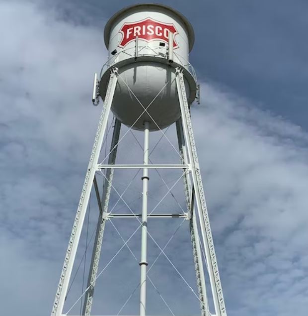
11. Frisco, Texas
Frisco is a city in Texas’s Denton and Collin counties. It is also part of the Dallas-Fort Worth metroplex and is approximately 25 miles from Dallas/Fort Worth International Airport and Dallas Love Field. Frisco was ranked one of the fastest-growing cities in the United States in 2017. Frisco, like other cities in Dallas’ northern suburbs, is a bedroom community for professionals working in the Dallas-Fort Worth metroplex.
History of Frisco, Texas
The Preston Trail, which originally began as an Indian walk from the Red River south to Austin, was used by most families who traveled to the north Texas prairie. Millions of longhorn cattle were transported along this route to markets on the north side of Texas before it was eventually given the name Shawnee Trail. The cattle enjoyed a dry path thanks to the trail’s white rock ridge. The community of Lebanon was founded along this trail because of all these operations, and it was given a US post office.
A settlement grew up around this rail stop after a route of the St. Louis-San Francisco Railway was established through the area in 1902. Numerous people choose to relocate to the new neighborhood considering the numerous new chances. Emerson was the original name of this new town. Though the U.S. The name was rejected by the S Postal Service because it was too like the name of another Texas city. Because of this, the locals chose the name Frisco City for their town in 1904 to pay homage to the St. Louis-San Francisco Railway. Years later, they decided to shorten it to Frisco.
Frisco continued to be a major agricultural hub for many years, and at one point it even had five active cotton gins. Despite being a center for agriculture, Frisco had a population of under 2,000 until the 1980s, when it began to grow rapidly. Because of its enviable location, forward-thinking leadership, and high standard of living in the area, Frisco was the American city with the highest population growth in the 1990s.
Frisco’s Geographic Coordinates
With a total area of 62.4 square miles (161.6 km2), Frisco, Texas is made up of 160.1 km2 (61.8 square miles) of land and 0.58 square mile (1.5 km2), or 0.92%, of water.
Population
Frisco have a population of 217,213 in 2020. Frisco is increasing at a rate of 4.00% each year, and its population has expanded by 8.33% since the last census, which reported a population of 200,509 in 2010.
Frisco has a median household income of $153,704 and a poverty rate of 4.03%. In recent years, the median rental rate has been $1,508 per month, with a median dwelling value of $420,700. Frisco’s median age is 37.1 years, with males being 37 years old and females being 37.1 years old.
- Population: 217,213
- Population Growth: 8.33%
- Area: 62 square miles
- Average Age: 37
- Average Household Income: $153,704
- Average Home Price: $420,700
List of other Major Cities in the Dallas Fort-Worth Region
- McKinney
- Grapevine
- DeSoto
- Rowlett
- Carrollton
- Allen
- Farmers Branch
- Prosper
- Melissa
- Little Elm
- Denton
Interesting Facts About the Dallas Fort-Worth
- Dallas Texas is the 9th largest in terms of population in the United States.
- Mark Cuban, an American billionaire entrepreneur is the owner of the Dallas Mavericks basketball team in the NBA.
- In the early 1900s, Dallas Texas was a major producer of wholesale alcoholic drinks and media products including books and medicine.
- Out of all the communities in North Texas, Westlake, a small hamlet north of Fort Worth, has the highest average yearly family income ($526,590).
- In 2010, Dallas Fort-Worth was the 12th richest in the nation.
- Highland Park which is in Dallas-Fort Worth is one of the most luxurious homes to live in.
- In the year 1856, Dallas was incorporated as a City.
- The elevation above Dallas Texas is 456 feet.
- Dallas is where the word “Super Bowl” was first used.
- The world’s largest art district is in Dallas Texas.
- The Dallas Cowboys are one of the most thrilling sports teams that have ever competed on a global platform in the NFL Football League.
- Did you know that the term German chocolate did not originate in Germany but in Dallas?
- One of Irving’s unique characteristics is that it has some of Dallas/Fort Worth’s best dining establishments.
- Irving’s top industry is hospitality.
- Texas’s Irving is home to the Boy Scouts of America’s national headquarters.
- Before Irving was officially created in 1903 by Otis Brown and Otto Schukze, the city was first known as Gorbit and then Kit.
- The disaster of Delta Air Lines Flight 191 as it approached Dallas Fort Worth International Airport on August 2, 1985, is considered one of the worst days in Irving’s history.
- Due to miscommunication at the Postal Service offices, the city of Grand Prairie was renamed from Dechman to Grand Prairie.
- The world-renowned singer and actress Selena Gomez were born in Grand Prairie Texas.
- The city with the fifteenth highest population in this state is Grand Prairie.
- Over three million lights make up the more than two-mile-long Christmas light display in Grand Prairie.
- KRDL, a well-known Dallas radio station, constructed its radio antenna tower in Garland, Texas, and it is still in use today.
- Garland is a very green community with 60 parks, 2,880 acres of parkland, and 6 recreation facilities.
- The United States Printing Office produces 60% of America’s paper money at the Western Currency Facility of the Bureau of Engraving and Printing in Fort Worth
- President John F. Kennedy gave his final public statement at a Fort Worth Chamber breakfast before leaving for Dallas in 1963.
- On June 26, 1956, voters in Richardson, Texas, approved a home rule charter and the council/manager form of government that is still in place today.
- The League of American Bicyclists named Richardson, a Bronze Bicycle Friendly Community. Richardson has a long-term strategy to build bicycle infrastructure and designate preferred cycling routes on low-volume, low-speed roads.
- Richardson currently has more than 15 kilometers of bike lanes.
- Did you know that Texas is larger than any country in Europe?
References:
[1] Dallas Fort-Worth Metroplex. Free Travel Guide. Available At:
https://wikitravel.org/en/Dallas-Fort_Worth_Metroplex
[2] Dallas Fort-Worth Metroplex. Geography. Available At:
https://en.wikipedia.org/wiki/Dallas%E2%80%93Fort_Worth_metroplex#Geography
[3] What is Conurbation? Available at:
https://en.wikipedia.org/wiki/Conurbation
[4] Dallas History. Available at:
http://www.world-guides.com/north-america/usa/texas/dallas/dallas_history.html
[5] Dallas County. Available at:
https://brothersmovingtexas.com/blog/cities-in-dallas-county/#1_Dallas
[6] Dallas Geography and Climate. Available at:
https://www.city-data.com/us-cities/The-South/Dallas-Geography-and-Climate.html
[7] About Irving. History. Available at:
https://www.irvingtexas.com/plan-your-visit/about-irving/history/
[8] Irving Geographic Coordinates. Available at:
https://dateandtime.info/citycoordinates.php?id=4700168
[9] Irving, Texas Population. Available at:
https://worldpopulationreview.com/us-cities/irving-tx-population
[10] Garland History. Available at:
https://www.garlandtx.gov/325/Garland-History
[11] Garland Population. Available at:
https://www.populationu.com/cities/garland-tx-population
[12] Mesquite History. Available at:
https://www.downtownmesquitetx.com/p/explore/downtown-mesquite-history
[13] Arlington History. Available at:
https://www.arlingtontx.gov/residents/about_arlington/history_of_arlington/arlington_history
[14] Arlington Population. Available at:
https://worldpopulationreview.com/us-cities/arlington-tx-population
[15] Fort Worth History. Available at:
https://www.fortworthtexas.gov/about/history
[16] Plano, Texas History. Available at:
https://visitdowntownplano.com/our-history/
[17] Plano, Texas Population. Available at:
https://worldpopulationreview.com/us-cities/plano-tx-population
[18] Plano History: Available at: https://texashappens.com/things-to-know-about-richardson-tx/
[19] Richardson History: Available at: https://texashappens.com/things-to-know-about-richardson-tx/
[20] Richardson, Texas Population: Available at:
https://worldpopulationreview.com/us-cities/richardson-tx-population
[21] Addison History: Available at:
https://addisontexas.net/econ-dev/history-addison
[22] Addison, Texas Population: Available at:
https://worldpopulationreview.com/us-cities/addison-tx-population
[23] Things to know about Frisco, Texas: Available at:
[24] Frisco, Texas Population: Available at:
https://worldpopulationreview.com/us-cities/frisco-tx-population
Table of Contents
