Introduction
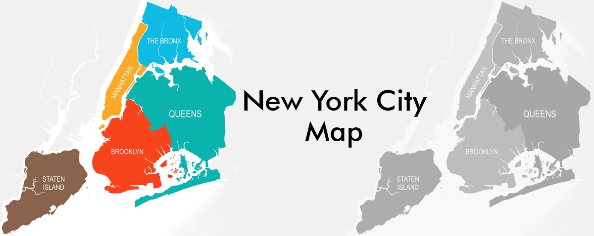
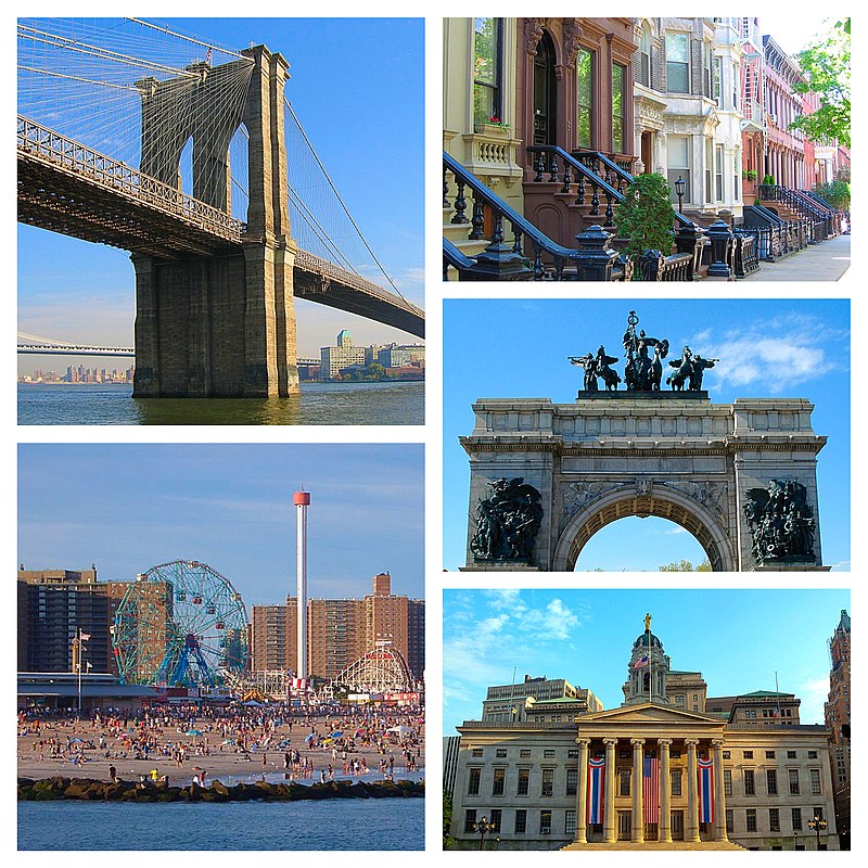
The most populous city in the United States is New York City, often known as “New York”, “NYC”, and “The Big Apple.” It is situated in the southernmost region of the state of New York, close to the Hudson River’s mouth. New York City is home to people from all over the world, making it one of the most culturally diverse cities in the world. There is something for everyone to enjoy in the city’s five boroughs.
Many people are familiar with the five boroughs that make up New York City: Manhattan, Brooklyn, the Bronx, Queens, and Staten Island. In 1898, the boroughs were incorporated and merged with New York City to form the city that people recognize today. Although each borough is a component of the city, it is also a separate county. As such, each borough has its own borough president, who serves as a ceremonial leader and also advises the mayor of New York City on borough finances, land usage, and upcoming projects. The creation of the New York City subway system in 1904 was crucial to ensuring that people of various regions of the city could move around as required. [1]
The Bronx
The Bronx is the northernmost of New York City’s five boroughs. It is surrounded by the Harlem and East rivers.
History
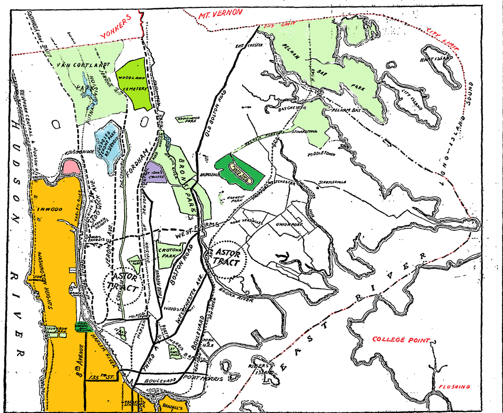
The Bronx is a borough of both New York City and Bronx County, which are both located in the state of New York in the United States. The Bronx River divides the borough between a hillier area in the west and a flatter section in the east. The names of east and west streets are separated by Jerome Avenue. New York City annexed the West Bronx in 1874 and the portions east of the Bronx River in 1895. [2]
By the late 1890s, there was substantial support in portions of Eastchester, Pelham, and Wakefield for merging the territory east of the Bronx River with New York City, along with Brooklyn, Queens, and Staten Island. Most individuals believed that the high real estate prices in Manhattan would cover the municipalities’ existing debt and pay for the anticipated public upgrades.
After amalgamation in 1898, the twenty-third and twenty-fourth wards created the borough of the Bronx, which remained a part of New York County along with Manhattan. However, it wasn’t until 1912 that the Bronx County assembly officially recognized the area as the state’s sixty-second county, with the new designation taking effect on January 1, 1914. The Bronx’s economy increased fast over the first three decades of the twentieth century due to the inflow of new residents. In the process of extending the 3rd Avenue elevated line northward, trolley lines were linked to it, providing a fast transit system that allowed access from lower Manhattan to vast tracts of undeveloped country.
In 1904, the first subway connecting the Bronx to Manhattan was constructed beneath 149th Street, providing inexpensive rapid transit that, along with the 3rd Avenue elevated line, convinced hundreds of thousands to leave Manhattan’s tenements for spacious new apartments in the Bronx during the first third of the 20th century. Among those who relocated were Yugoslavians, Armenians, and Italians, but the greatest group was comprised of Jews from central and eastern Europe. [3]
Geography
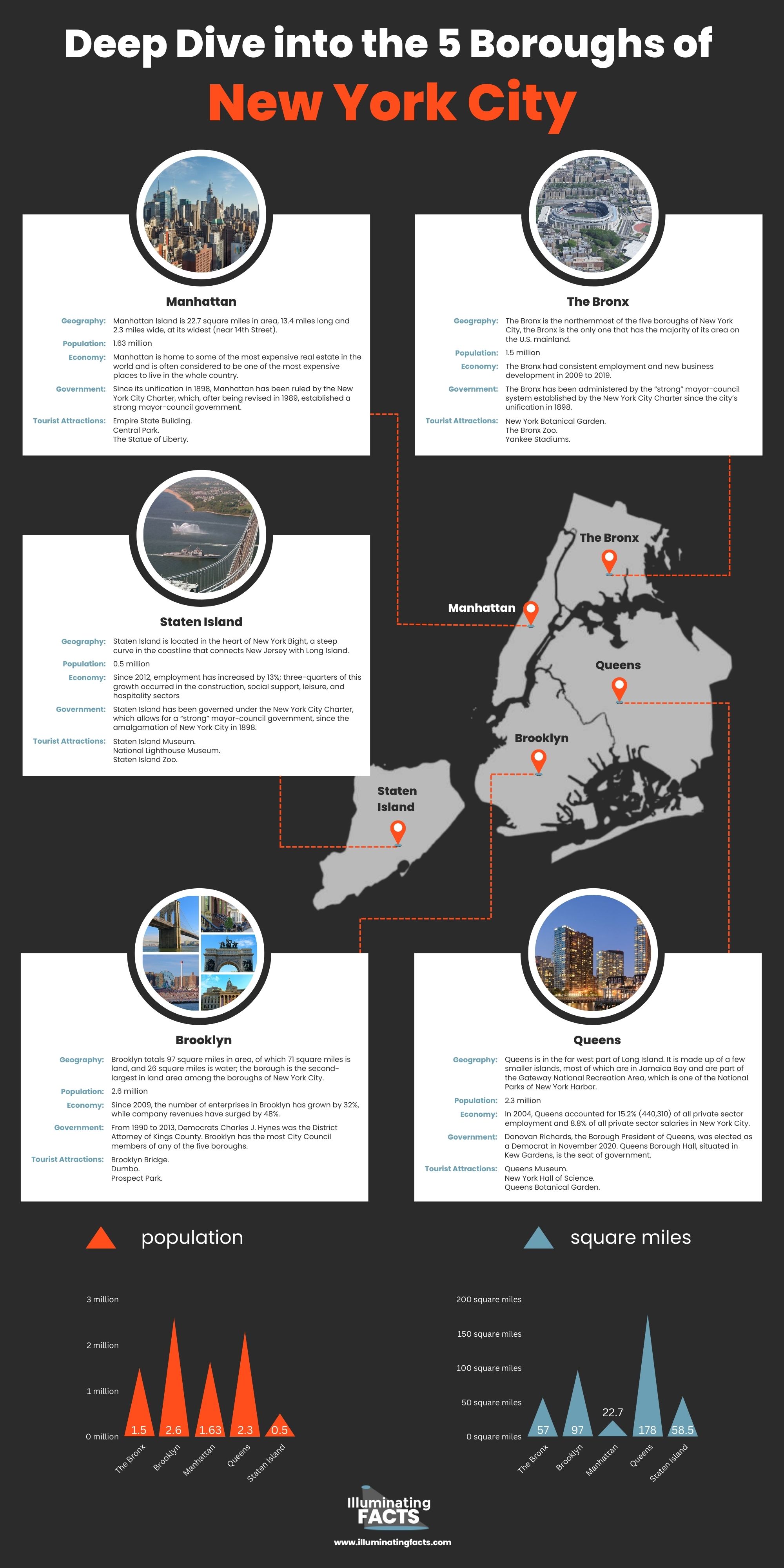
The Bronx is the northernmost of New York City’s five boroughs, and it is the only one whose landmass is mostly located inside the continental United States and has the fourth-highest population, with 1.5 million people. The Bronx is split into two halves by the Bronx River: a hillier area in the west, closer to Manhattan, and a flatter section in the east, closer to Long Island. With a total area of 57 square miles, the borough ranks only fourth among New York City’s boroughs in terms of size. [4] [5]
The highest elevation in the Bronx, at 280 feet (85 m), is located in the northwest portion, west of Van Cortlandt Park and in the Chapel Farm neighborhood near Riverdale Country School. Hunt’s Point, Clason’s Point, Screvin’s Neck, and Throggs Neck are four huge low peninsulas or “necks” that protrude into the East River and were previously salt marsh on the other (southeast) side of the Bronx. Rodman’s Neck is located between Pelham Bay Park in the northeast and City Island farther along the coast. The Bronx’s uneven coastline is 75 square miles in size (194 km2). [2]
Population
Bronx is the most populous county in the United States, and the northernmost borough. As of 2017, the Bronx has a population of 1,471,160, making it the fourth most populated borough in New York. Its population density of nearly 35,000 people per square mile places it third among the five boroughs in terms of population density.
Almost 30% of the population is under 18 years old. The age group between 25 and 44 comprises more than 30% of the population. With 87 males for every 100 females, there are more women than men residing in the Bronx.
In 2017, the Bronx’s population was predicted to be 1.47 million people. This is an increase of more than 6% from the previous census in 2010. The population has grown significantly from the early nineteenth century, however there was a considerable reduction in population between 1970 and 1980. The population has subsequently recovered and has not yet surpassed the high recorded during the 1970 census. Looking back over the previous many decades, the development that has been documented suggests that this populated borough has more growth ahead of it in the future. [5]
Economy
From 2009 to 2019, the Bronx had consistent employment and new business development. In 2019, the number of employments in the borough increased by 20 percent, reaching 249,000. Although the borough’s employment growth lagged below the citywide average of 29.9 percent, it was the only borough to see no employment decrease during the Great Recession. Four industries, including health care, social assistance, leisure and hospitality, and retail, are seeing rapid job development.
Over 70 percent of residents in the Bronx are employed in essential or face-to-face industries, with the largest percentages working in health care and social assistance (25.9 percent), retail trade (10.2 percent), accommodation and food services (9.6 percent), and transportation and warehousing (7.7 percent). [6]
Government
The Bronx has been administered by the “strong” mayor-council system established by the New York City Charter since the city’s unification in 1898. The Bronx is part of New York City, which means that the city’s central government is in charge of public schools, jails, libraries, police, parks, utilities, and social programs.
In 1898, when New York City was consolidated into boroughs, the position of Borough President was established to strike a fair balance between central and local power. Each borough president’s vote on the New York City Board of Estimate, which sets and approves the city’s budget and plans for land use, gave them significant administrative authority. [2]
Residents of Bronx County pick a borough president and district attorney. The president is responsible for providing budget proposals to the mayor of New York, proposing legislation to the New York City Council, appointing borough members to commissions and boards, and conducting public hearings on borough-related matters. The five boroughs of New York have their budgets and projects approved by the city. The district attorney is in charge of prosecuting instances involving state law infractions. [7]
Tourist Attractions
- New York Botanical Garden. The New York Botanical Garden, hailed as one of New York’s finest achievements, is a sensory feast. The New York Botanical Garden, with over a million tropical, temperate, and desert flora homes over 250 acres, is one of the world’s greatest plant study and conservation initiatives.
- The Bronx Zoo. The Bronx Zoo is known across the globe for its huge and diversified animal collection, as well as its award-winning displays. The zoo is part of the Wildlife Conservation Society’s (WCS) integrated system, which includes four zoos and one aquarium, and it is accredited by the Association of Zoos and Aquariums (AZA).
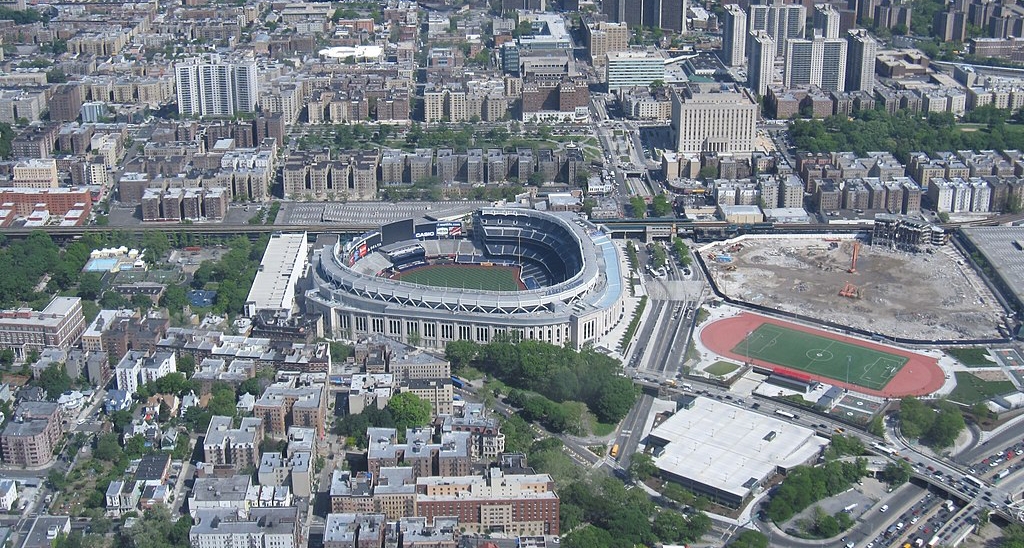
- Yankee Stadiums. Yankee Stadium, the home of the 27-time World Series champion New York Yankees, was constructed across the street from the previous stadium in 2009.
Bronx Facts
- The Bronx is home to the country’s biggest urban zoo.
- The Kennedy family lived in the borough.
- The Bronx is home to the first Hall of Fame.
- The Bronx was home to famous novelist Edgar Allan Poe.
Brooklyn
One of New York City’s five boroughs, Brooklyn was called after the Dutch city of Breukelen. Brooklyn, New York, has almost 2.5 million people, making it the most populated borough in New York City.
History
The western part of Long Island was originally colonized by Europeans, the Dutch, who found it predominantly occupied by the Canarsie Native American tribe. Midwout (now Midwood) was the first Dutch colony, founded in 1634. In 1664, when the British conquered New Netherland, the Dutch lost Breuckelen. The British restructured the Province of New York into 12 counties in 1683, with further subdivision into towns within each county.
In August and September of 1776, Kings County was the site of the Battle of Long Island, which is often anachronistically referred to as the “Battle of Brooklyn.” It was the greatest fight of the American Revolutionary War and the first significant combat to occur after the Declaration of Independence. With the signing of the Treaty of Paris in 1783, New York and Brooklyn won freedom from the British.
There were two cities within the county: Brooklyn and Williamsburg. In 1854, Brooklyn annexed Williamsburg. It took until 1896 for Brooklyn to acquire all of Kings County’s other municipalities.
In 1898, Brooklyn inhabitants voted by a narrow majority to join Manhattan, The Bronx, Queens, and Richmond (later Staten Island) to establish the five boroughs of contemporary New York City.
Geography
Brooklyn has a total area of 97 square miles (250 km2), of which 71 square miles (180 km2) are land and 26 square miles (67 km2) are water; it is the second-largest borough in New York City by land area. Brooklyn is located near the southwestern extremity of Long Island, and its western boundary is the westernmost point of the island.
The shoreline of Brooklyn faces many bodies of water. The East River defines the northern shore of Brooklyn, while the center of the borough borders New York Bay. This coastal region includes the Red Hook peninsula and the Erie Basin. Governors Island is separated from this section of the shoreline by Buttermilk Channel. Gowanus Bay is linked to the Gowanus Canal in the southwest. Brooklyn is separated from Staten Island by the Narrows, where the Upper and Lower New York Bays converge. [8] [9]
Population
Brooklyn is the most populated and biggest of New York City’s five boroughs. It has the same borders as Kings County, which is also the most populous county in the state and, after New York County/Manhattan, the second-most densely inhabited county in the nation. If Brooklyn were a city, it would be the fourth most populated in the United States.
Brooklyn has an estimated population of 2,6 million with a population density of 36,732 people per square mile or 14,182 people per square kilometer, which is quite high. The borough’s history dates back 350 years, and it has been a favored destination for immigrants to the United States for decades. [10]
Economy
Since 2009, the number of enterprises in Brooklyn has grown by 32%, while company revenues have surged by 48%. This was the quickest rate of increase among the five boroughs, and it was almost twice the citywide rate of growth (17 percent). With the exception of manufacturing, the number of enterprises grew in every business sector over this time period. Leisure and hospitality, business services, personal services, and retail commerce all contributed to growth.
Employment in the private sector hit a record high in 2017, a 39 percent growth from 2009.
The unemployment rate decreased from 9.9 percent in 2010 to 4.6 percent in 2017, marking the lowest yearly figure since the data series was established in 1990. [11]
Government
Each of New York City’s five counties, which are the same as its five boroughs, has its own criminal court system and its own District Attorney, who is the city’s top prosecutor and is directly elected by the people. From 1990 to 2013, Democrats Charles J. Hynes was the District Attorney of Kings County. Brooklyn has the most City Council members of any of the five boroughs. It has 16 of them. The Brooklyn Borough Government has a borough government president, a court, a library, a borough government board, a head of borough government, a deputy head of borough government, and a deputy borough government president. [12]
Tourist Attractions
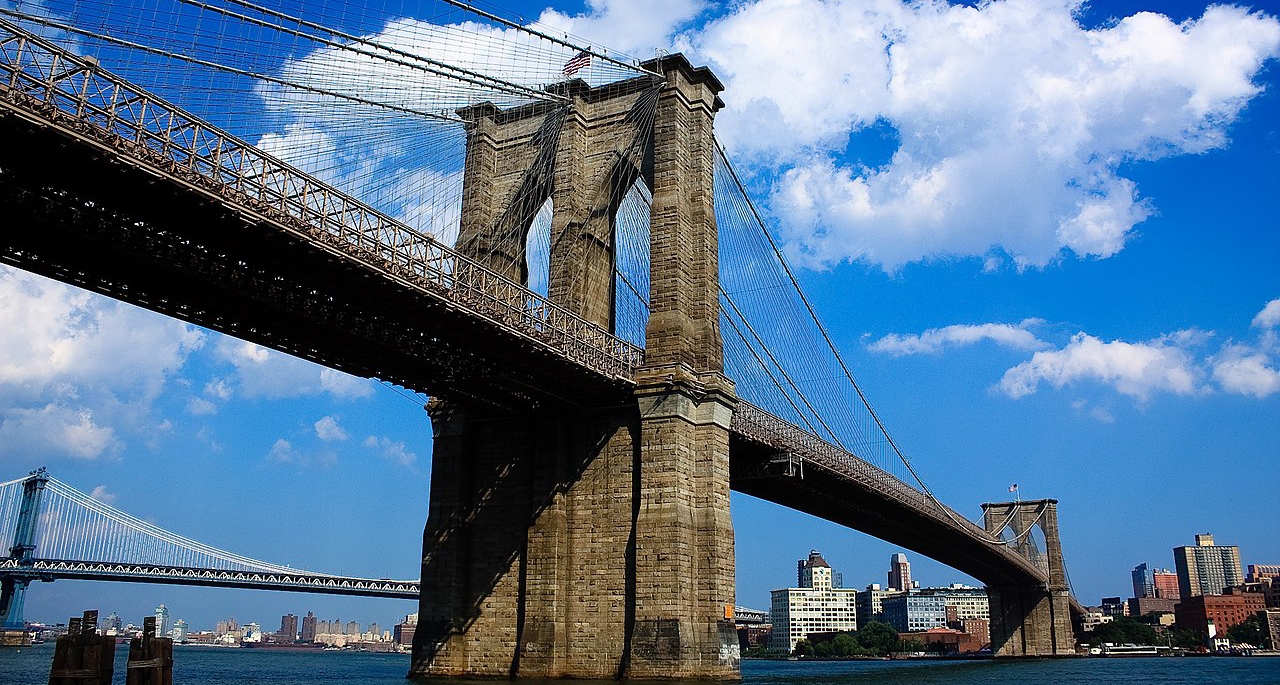
- Brooklyn Bridge. The Brooklyn Bridge is among New York’s most significant historic landmarks. It is also a vital component of the city’s infrastructure, crossing the East River between Manhattan and Brooklyn.
- Dumbo. A northern Brooklyn waterfront neighborhood is one of the borough’s most elegant and attractive communities. The cobblestone alleys and repurposed warehouses of Dumbo are home to stylish galleries, boutiques, coffee shops, and one of the city’s most renowned pizza restaurants.
- Prospect Park. Located in the middle of Brooklyn, on more than 500 acres (202 hectares), Prospect Park is an ideal spot to escape the hustle and bustle of the city. The park offers woodland walks, sunbathing, and car-free cycling and jogging—a terrific area to see New York’s natural beauty.
Brooklyn Facts
- El Diario La Prensa, the country’s oldest and biggest Spanish-language daily newspaper, Hamodia, an Orthodox Jewish weekly, and more than 300 other non-English newspapers and publications are published in Brooklyn.
- Prospect Park is the biggest public park in Brooklyn.
- Under the Brooklyn Bridge, a bomb shelter from the Cold War was found in 2006.
- Former President Barack Obama once resided in a Brooklyn brownstone.
Manhattan
Manhattan is one of the five boroughs of New York City. Locals call Manhattan “The City.” It has the most people per square mile and is the smallest of New York City’s five boroughs. It is the urban center of the New York metropolitan area and is the same size as New York County, one of the original counties in the U.S. state of New York.
History
When most people think of New York, Manhattan comes to mind. The island is also a county of New York. The city was constructed around this borough, and the others were added over time. The name “Manhattan” is derived from the Lenape Indians’ term Mannahatta, which means “country of many hills.”
Lenape Indians were the earliest inhabitants of the region now known as Manhattan, but Henry Hudson was the first Englishman to survey the area during his journey up the river that bears his name. In 1625, the territory was acquired from the Lenape Indians for the equivalent of a few thousand dollars or less in order to construct Fort Amsterdam, a site of welcome for incoming immigrants. New York City participated in a number of conflicts during the Revolutionary War and served as the nation’s capital from March 1789 to April 1790. After the American Civil War, New York had an influx of immigrants and received the Statue of Liberty as a gift from France.
In 1898, when Manhattan was founded as its own borough of New York City, it had a white population of 98.7%; by 1990, that percentage had plummeted to 58%. The city expanded swiftly and continues to attract immigrants from all around the globe.
Geography
Fifth Avenue divides Manhattan’s east and west sides, separating Downtown (Lower Manhattan), Midtown (Midtown Manhattan), and Uptown (Upper Manhattan). The Hudson River borders Manhattan Island on the west, and the East River on the east. The Harlem River separates Manhattan Island from The Bronx and the continental United States to the north.
Several tiny islands, notably Randall’s Island, Wards Island, and Roosevelt Island in the East River, and Governors Island and Liberty Island to the south in New York Harbor, are also part of the borough of Manhattan. Manhattan Island has an area of 22.7 square miles (59 km2), is 13.4 miles (21.6 km) long, and is at its broadest point 2.3 miles (3.7 km) wide (near 14th Street). The total area of New York County is 33.77 square miles (87.5 km2), with 22.96 square miles (59.5 km2) of land and 10.81 square miles (28.0 km2) of water. [13]
Population
Manhattan is home to an estimated 1.63 million people who live in a 23-square-mile region. Manhattan has a population density of 70,826 people per square mile, or 27,346 people per square kilometer. Manhattan is the most densely inhabited of the five boroughs of New York City, as well as the most densely populated county in the United States. It is more densely inhabited than any other city in the in the United States.
Manhattan is the borough with the lowest geographical area and the third-largest population after Brooklyn and Queens. Between 2000 and 2030, Manhattan’s population is projected to increase by 289,000 people. The school-age population is forecast to expand, despite a general drop in New York City, while the senior population is expected to grow by 58%. [12]
Economy
Manhattan is home to some of the most expensive real estate in the world and is often considered to be one of the most expensive places to live in the whole country.
Nearly two-thirds of all employment in New York City can be traced back to the island of Manhattan, making it the economic backbone of the city. The daytime population of Manhattan is 3.94 million, with commuters contributing an additional 1.34 million people. This commuter flood of 1.61 million employees into Manhattan was more than any other county or city in the US, and it was more than three times the number of commuters who traveled to Washington, D.C., which ranked second.
Its most significant economic sector is the banking industry, whose 280,000 employees earned more than half of the borough’s total salaries. The securities business, whose epicenter is Wall Street, is the biggest section of the city’s financial sector, accounting for over fifty percent of employment in financial services. Prior to the 2008 financial crisis, the headquarters of the five major U.S. securities-trading businesses were located in Manhattan.
White-collar jobs make up the vast majority of Manhattan’s labor force, with just a tiny number employed in the manufacturing sector (39,800) and the construction industry (31,600). [14]
Government
Since its unification in 1898, Manhattan has been ruled by the New York City Charter, which, after being revised in 1989, established a strong mayor-council government. New York City’s centralized government is in charge of all of Manhattan’s public schools, jails, libraries, police, parks, pools, sewers, water mains, and social services.
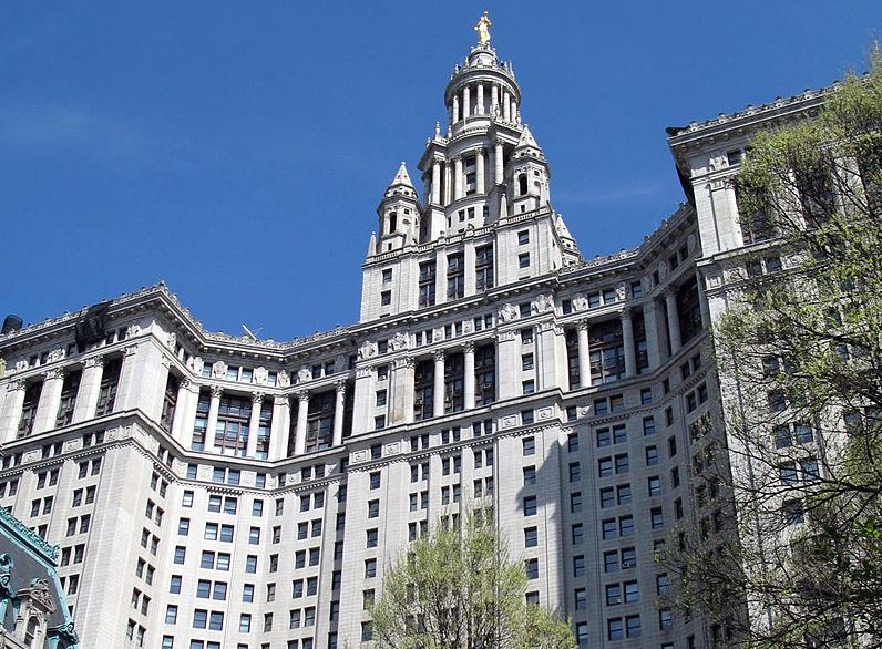
Manhattan has 10 members of the City Council, the third-largest number among the five boroughs. Additionally, each of its twelve administrative districts is administered by a Community Board. Community Boards are representative entities that handle resident grievances and advocate on their behalf. As the headquarters of the United Nations, the borough is home to 105 consulates, consulates general, and honorary consulates, the biggest foreign diplomatic corps in the world. It is also the location of New York City Hall, the government center of New York City, which houses the mayor and city council. The employees of the mayor and thirteen municipal departments are situated in the 1916-built Manhattan Municipal Building, one of the biggest government structures in the area. [15]
Tourist Attractions
- Empire State Building. This 1,454-foot Art Deco skyscraper, completed in 1931 at the height of the Great Depression, was the highest structure in the world for over four decades and has long served as a symbol of American creativity and ambition.
- Central Park. Between Manhattan’s Upper West and Upper East Sides is where you’ll find the urban park known as Central Park in New York City. With 843 acres, it is the fifth-largest park in the city (341 ha). With an estimated 42 million visits per year as of 2016, it is both the most popular urban park in the United States and the most often used filming location worldwide.
- The Statue of Liberty. The Statue of Liberty has been holding her torch high in New York Harbor since 1886 as the ultimate symbol of American liberty. The large pedestal of the monument has an observation deck as well as displays chronicling the intriguing history of the 305-foot copper statue sculpted by Frédéric Auguste Bartholdi and presented to the United States from France to commemorate the two countries’ friendship.
Manhattan Facts
- Manhattan has the most expensive cost of living in the U.S., but it also has some of the biggest differences in income in the country.
- Manhattan is one of the richest areas in the United States and the only county with a per capita income of over $100,000.
- Times Square is located in Manhattan.
- In the Algonquian Indian language, Manhattan translates to “island of the hills.”
Queens
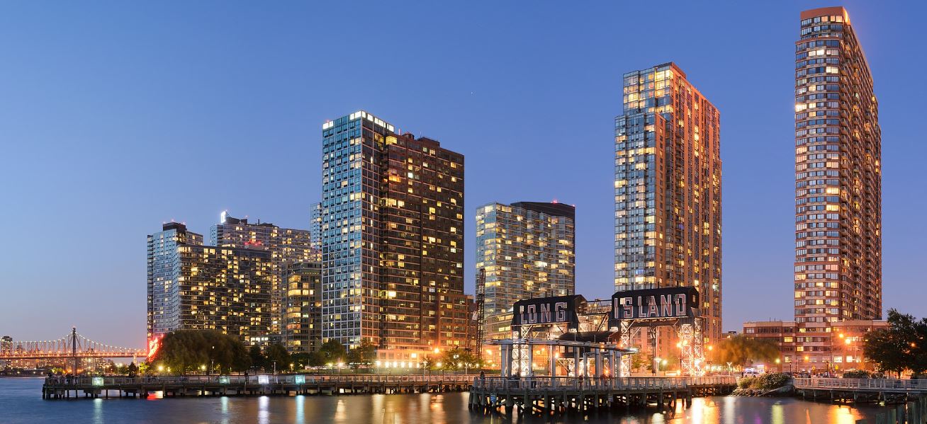
Queens, the biggest and most eastern of New York City’s five boroughs, is located on the western end of Long Island, next to Brooklyn.
History
The Lenape, an Algonquian-speaking population from present-day New Jersey and Pennsylvania, were the earliest inhabitants of Queens. In the 1600s, the Dutch arrived in Queens, and the region became known as Newtown. Newtown was included into the Province of New York by the British in 1683. The region remained mostly rural until the 1800s, when urbanization developed.
It was in 1898 that Queens was officially recognized as a borough of New York City, and the following year, Flushing was designated as the county seat of Queens. After the Queensboro Bridge was completed and opened to traffic in 1909, the neighborhood quickly expanded. Numerous art deco and art Moderne apartment complexes were built in Queens in the 1920s and 1930s.
In the 1940s and 1950s, Queens saw a population boom as suburban-minded families migrated to the borough. Queens had a second wave of immigration from Asia and Latin America in the 1960s and 1970s. Queens is now one of the most ethnically diverse counties in America.
Geography
Queens is in the far west part of Long Island. It is made up of a few smaller islands, most of which are in Jamaica Bay and are part of the Gateway National Recreation Area, which is one of the National Parks of New York Harbor.
The Rockaway Peninsula, the most southern portion of Long Island, is situated between Jamaica Bay and the Atlantic Ocean and is home to Queens’ most popular public beaches. Flushing Bay and the Flushing River link to the East River in the north. The mouth of the East River is Long Island Sound. The Wisconsin Glacier’s Long Island-spanning terminal moraine traverses the central portion of Queens.
The county has an area of 178.3 square miles (462 km2), of which 109.2 square miles (283 km2) are land and 38.7% are water, according to the United States Census Bureau. [16]
Population
Queens has the second-highest population in the city, after only Brooklyn. With an estimated 2,358,582 persons in 2017, Queens has a population density of more than 21,000 people per square mile. Among the five boroughs, it has the fourth-highest population density.
Nearly half of the entire population is white, according to a breakdown of the population by race. Hispanics account for 28% of the population, followed by Asians at 26% and blacks at 20%. Queens’ population comprises more than 27% of New York City’s overall population and about 12% of the state’s total population.
Queens’s population has continuously increased throughout the years, with the biggest noticeable increase being between 1920 and 1930. Between the 2000 and 2010 censuses, the population rose by just 0.1%. In the eight years since the previous official census, Queens’ population has increased by over 6%, putting it on course to exceed 2.5 million inhabitants in the near future. [17]
Economy
When comparing the economies of the five boroughs that make up New York City, Queens is second only to Manhattan. In 2004, Queens accounted for 15.2% (440,310) of all private sector employment and 8.8% of all private sector salaries in New York City. Queens has the most diverse economy of the five boroughs, with employment fairly distributed across health care, retail commerce, manufacturing, construction, transportation, and film and television production.
Nearly 30% of all occupations in the borough were in commerce, transportation, and utilities in 2004. JFK International Airport and LaGuardia Airport, two of the three main airports serving the New York City region, are located in Queens.
Education and health services is the second biggest industry in Queens, accounting for over 24% of the borough’s employment in 2004. Queens’ major sectors are manufacturing and construction, which account for over 17% of the borough’s private sector employment. Information, financial activities, and commercial and professional services account for over 17 percent of all occupations in Queens. [18]
Government
Since 1990, the Borough President has served as the borough’s representative in mayoral agencies, the City Council, the New York State government, and companies. Donovan Richards, the Borough President of Queens, was elected as a Democrat in November 2020. Queens Borough Hall, situated in Kew Gardens, is the seat of government.
Each of the city’s five counties has its own criminal court system and chief public prosecutor, called the District Attorney, who is directly elected by the people. Queens has 12 council seats, which is the second most of any of the five boroughs. It has 14 community districts, each of which is run by a local Community Board. Community boards are made up of people who live in the area and listen to complaints and speak up for them. [19]
Tourist Attractions
- Queens Museum. The Queens Museum, which used to be called the Queens Museum of Art, is in a sleek, modern building in Flushing Meadows Corona Park that was built for the 1964 World’s Fair. It has exhibits about architecture, art, and design.
- New York Hall of Science. Also constructed for the 1964 World’s Fair, the New York Hall of Science (NYSCI) makes science accessible and enjoyable for children and adults. This family-friendly museum is situated in Flushing Meadows Corona Park and has 450 interactive exhibits, seminars, and activities spread over 100,000 square feet of area.
- Queens Botanical Garden. The 39-acre sanctuary in the heart of Queens has 25 beautiful gardens for guests to explore. The Queens Botanical Garden in Flushing was established during the 1939-1940 World’s Fair as the “Gardens on Parade” show and has since evolved to include a number of gardens worth seeing on a trip to Queens.
Queens Facts
- The US Open is held in Arthur Ashe Stadium in Flushing, Queens.
- Queens is home to some of the top Hip Hop musicians in the country, including Nicki Minaj, LL Cool J, Nas, and Mobb Deep.
- The borough has nearly 80 subway stations, ranking third in the country.
- One Court Square (commonly known as Citicorp Skyscraper) is the highest building in Queens, with 50 stories and a height of 205m.
Staten Island
Staten Island is a borough of New York City in the U.S. state of New York, coextensive with Richmond County.
History
Giovanni da Verrazano found the island in 1524. The Raritans and Unamis Indians lived there mostly until about 1630, when the Dutch tried to set up settlements there. The Dutch called it Staaten Eylandt, but they couldn’t keep a settlement there because the Indians, who felt threatened by the settlers, drove them away.
Wars and fights finally stopped in 1661. The Dutch built Old Town, also called Oude Dorp, near the South Beach area of Staten Island. When the English took over the city in 1664 for King Charles II, they changed its name to honor his son, the Duke of Richmond. By the end of the 17th century, there were reportedly 1,063 people living on Staten Island.
In 1894, Staten Islanders voted 5 to 1 in favor of joining New York City in a non-binding referendum (5,531 to 1,505). Support from the other boroughs was surprisingly weak. The borough of Brooklyn was virtually evenly divided. Despite the opposition of the mayor of New York/Manhattan, the New York State Legislature accepted the incorporation of Staten Island into the City in 1897. [20]
Geography
The combined borough and county span an area of about 265.5 square kilometers (102.5 sq mi), according the United States Census Bureau. Out of a total area of 151.5 square kilometers (58.5 square miles), only 44.0 square miles (114.0 square kilometers) are water.
The Narrows divide Staten Island from Long Island, while the Arthur Kill and Kill Van Kull separate it from mainland New Jersey. Staten Island is located in the heart of New York Bight, a steep curve in the coastline that connects New Jersey with Long Island. The area is thought to be susceptible to sea-level rise.
The summit of Todt Hill, at an elevation of 410 feet (125 meters), is not only the highest point in Staten Island, but also the highest point in the five boroughs, the southernmost point of the Atlantic Coastal Plain south of Great Blue Hill in Massachusetts, and the southernmost point of the coast proper south of Maine’s Camden Hills. [21]
Population
Despite being the third-largest in size at 59 square miles, Staten Island has the smallest population of the five boroughs, with an estimated 475,000 residents. Some of the locals there even call it “the forgotten borough” because they feel that they’ve been forgotten. In terms of population density, Staten Island is home to 3,132 people per square mile (8,112 people per square kilometer).
The North Shore, including the communities of Stapleton, Clifton, Tompkinsville, and St. George, is the most urban area of the island. However, the East Shore is home to the FDR Boardwalk, the world’s fourth-longest at 2.5 miles. West Shore is sparsely inhabited and home to several factories, whereas South Shore is dominated by suburban communities. [22]
Economy
Since 2012, employment has increased by 13%; three-quarters of this growth occurred in the construction, social support, leisure, and hospitality sectors. Currently, healthcare remains the leading employment in the borough, although significant investments are being made on the north shore to generate even more economic opportunities for citizens.
Over the last year, the employment market on Staten Island has grown by 0.5%. In the next 10 years, employment growth is expected to be 32.0%, which is lower than the US average of 33.5%.
Staten Island has a 9.8 percent unemployment rate. [23]
Government
Staten Island has been governed under the New York City Charter, which allows for a “strong” mayor-council government, since the amalgamation of New York City in 1898.
Staten Island’s politics vary significantly from those of the other boroughs of New York City. Despite the fact that in 2005, 44.7% of registered voters in the borough were Democrats and 30.6% were Republicans, the Republican Party controls a slight majority of local public posts. Staten Island serves as the Republican Party’s citywide election headquarters in New York City.
There is a separate criminal court system and District Attorney, the city’s main public prosecutor, who is directly elected by the people in each of the five counties (which correspond to the five boroughs). Staten Island has the fewest City Council members among the five boroughs, with two Republicans and one Democrat.
Additionally, it has three administrative districts, each of which is overseen by a Community Board. Community Boards are representative entities that handle resident grievances and advocate on their behalf. [24]
Tourist Attractions
- Staten Island Museum. The Staten Island Museum is the only general-interest museum left in the whole city. It is housed in the old dormitory for retired seafarers on the grounds of the Snug Harbor Cultural Center. The museum, founded in 1881, concentrates on the arts, natural sciences, and regional history for children of all ages.
- National Lighthouse Museum. More than 180 lighthouse artifacts and displays are on display at the National Lighthouse Museum. The museum’s primary focus is on documenting and conserving American lighthouse and lighthouse keeper history.
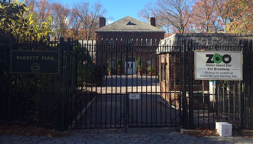
- Staten Island Zoo. The famed Serpentarium at Staten Island Zoo lives up to its “biggest little zoo” nickname, housing an impressive collection of reptiles, including the largest collection of rattlesnakes, in a 16,000-square-foot building. In an eight-acre site, the zoo exhibits around 800 species.
Staten Island Facts
- Staten Island is the only borough with a majority of non-Hispanic white people.
- Staten Island is connected to Manhattan through the Staten Island Ferry, which also provides views of Ellis Island and the Statue of Liberty.
- Prior to its closure in 2001, Staten Island was the biggest landfill in the world. It was briefly reopened to accept debris following the terrorist attacks on September 11th.
- Henry Hudson called the area Statten Eylandt in 1609.
References:
- https://www.topviewnyc.com/packages/know-your-city-new-york-s-five-boroughs#:~:text=The%20five%20boroughs%20that%20make%20up%20New%20York,create%20the%20city%20people%20are%20familiar%20with%20today
- https://en.wikipedia.org/wiki/The_Bronx
- https://www.thirteen.org/bronx/history2.html
- https://newyorkunimiskolc.wordpress.com/geography/
- https://worldpopulationreview.com/boroughs/bronx-population
- https://www.osc.state.ny.us/press/releases/2021/06/dinapoli-releases-economic-report-bronx
- https://ballotpedia.org/Government_of_Bronx_County,_New_York
- https://www.newworldencyclopedia.org/entry/Brooklyn
- https://kids.kiddle.co/Brooklyn#Geography
- https://worldpopulationreview.com/boroughs/brooklyn-population
- https://www.osc.state.ny.us/files/reports/osdc/pdf/report-3-2019.pdf
- https://worldpopulationreview.com/boroughs/manhattan-population
- https://www.liquisearch.com/manhattan/geography
- https://www.primidi.com/manhattan/economy
- https://www.liquisearch.com/manhattan/government#:~:text=Since%20New%20York%20City%27s%20consolidation%20in%201898%2C%20Manhattan,strong%20mayor-council%20system%20since%20its%20revision%20in%201989.
- https://www.brandonjbroderick.com/history-of-Queens
- https://worldpopulationreview.com/boroughs/queens-population
- https://www.liquisearch.com/queens/economy
- https://en.wikipedia.org/wiki/Queens#Government
- https://statenislandfilmlocations.com/history-of-staten-island/
- https://worldpopulationreview.com/boroughs/staten-island-population
- https://statenislandfilmlocations.com/history-of-staten-island/
- https://edc.nyc/staten-island
- https://www.liquisearch.com/staten_island/government_and_politics

